46
2016
( - يونيو
373
العدد )
الجمعية الكويتيه لحماية البيئة
البيئة
New Jersey for Hurricane
Sandy. GIS mapping
assisted in defining facilities
most at risk, including key
residences and businesses;
critical infrastructure such as
power plants and water and
wastewater treatment facilities;
hospitals and schools; and
police, fire, and emergency
medical service (EMS)
stations. Furthermore, FEMA,
through the National Flood
Insurance Program (NFIP),
provided maps of flood-prone
areas and historical data on
property flooding insurance
claims as part of its mandate to
reduce the impact of flooding
on private and public structures
by providing affordable
insurance to property owners
and encouraging communities
to adopt and enforce floodplain
management regulations.
Analysis of this data—i.e.,
essential elements of
information—assisted
emergency managers in their
attempt to determine overall
potential storm impact.
This led to consequence
management solutions
projecting when to order
evacuations, how many
potential individuals would
evacuate, and how many
shelters would be required to
open. Less than 48 hours prior
to landfall and as the forecast
solidified, analysis revealed a
significant concern regarding
the state’s barrier islands, a
thin inhabited strip projected
to be completely flooded due
to storm surge. Mandatory
evacuations were urged—as
was the movement of police,
fire, and EMS equipment
projected to be destroyed in
the flood surge. Subject-matter
experts from the energy sector
projected a potential loss of
power to 3 million customers,
which caused concern as that
would mean a significant
recovery period of weeks for
restoration of power. This then
projected into a significant
requirement for generators and
a severe shortage of fuel.
Based upon these projections,
evacuations were ordered,
shelters were opened, assets
in danger were moved, and
projected resource needs were
pre-positioned.
Understanding the Impact,
the What’s Next
Hurricane Sandy made landfall
near Atlantic City on October
29, 2012, at approximately 8
p.m. The 933-kilometer–wide
storm produced 158 kph winds
as it moved northwest toward
the New Jersey coast as a
Category 1 hurricane. A new
state record was set for lowest
recorded barometric pressure
(an indicator of storm strength)
at 27.94 inches at landfall.
Hurricane Sandy’s impacts
on New Jersey included
high winds with hurricane-
force gusts, storm surge,
and significant rainfall.
Surge heights were “major
to record”—i.e., in the 2- to
3-meter range—along the
coast, resulting in major
inundation of coastal areas
and overrun barrier islands.
Rainfall amounts were up to 18
centimeters for most locations
in New Jersey.
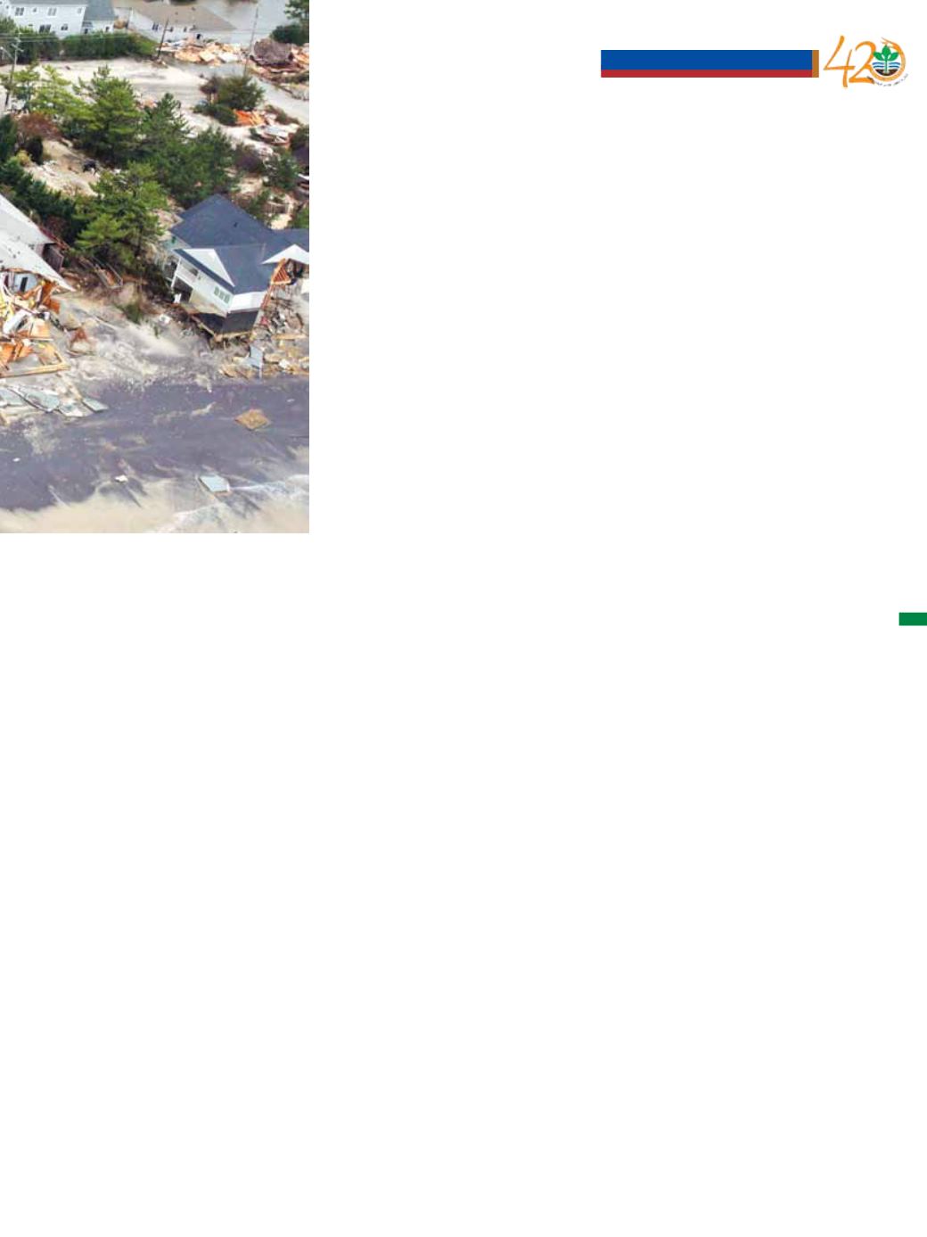
Storm surge along the New
Jersey coast
Once the storm passed, the task
of the New Jersey Emergency
Operations Center (with
support from FEMA) was to
determine the extent of damage
to the state, what resources and
processes would be required
to support basic human needs,
and what would be required for
recovery and reconstruction.
The process of developing
situational awareness after the
disaster was more challenging
due to several factors such as
power and communications
loss, overwhelmed local
governments, and an overload
of incomplete data. FEMA
established Disaster Recovery
Offices where people and
businesses could seek support
أخبار الجمعية
Awareness


